Municipality:
La Matanza de Acentejo

History
Before the Castilian epoch, the municipality was integrated under the Menceyato de Taoro and in the Menceyato de Tacoronte (depending wherefrom it is reading, we can find it inside one or another one, or of both Menceyatos).
Always it has been characterized for being a municipality of the slopes and of irregular volcanic washes. The limit is divided between the Ravine of La Cabrera with El Sauzal, and the San Antonio one with La Victoria.
 |
| View from La Matanza |
In this municipality Los Guanches obtained the victory on the conquerors (if there there comes the name of the municipality, taken on the battle that the Original inhabitants of the Canary Isles gained on the Castilians), event that it forced Fernandez of Lugo to retire from the island and to look for reinforcements. It was in Acentejo's ravine (though it is doubted on the exact place) where the battle takes place, taking advantage Los Guanches of the local orography for the ambush.
Since it finishes the conquest, in the territory cereals and grapevine are cultivated. In the XVIIth and XVIIIth century the development of the vineyard (especially the white one, the red wine interferes at the end of the XVIIIth) in this zone, raises it to the regional hegemony, close to La Victoria. There exists a small elite of local owners (though most they were laborers and lessees), enriched with the benefits of the wine and the agriculture for the subsistence. But the majority of the fertile lands concerned to oligarchies laguneras (people from La Laguna) and orotavenses (people from La Orotava). In the high and medium zones they predominate over the cereals, wheat, and then it appears eats it and the mill.
 |
| Some houses |
This municipality does not remain exempt from the wine crises that were lived, by what they are summarized in migrations. It is the wheat the production that manages to survive. With the migrations of the males to obtain send, in the field relevancy charges more the women and children. During the whole history, the municipality being seen the inhabitants declining and to get bigger, according to the crises or the economic recoveries that are happening.
In this municipality a deposit existed towards the ends of the XVIth. The crafts had representation very small. The Slaughter was a place of step obliged to all those persons who were going to the valley and northwest, for what it possessed from the ends of the XVIth a put and inn. In the population, they were not possessing doctors, but quacks.
 |
| Some houses |
The restaurants constitute the major source of employment in this locality. In the soil an essential culture of grapevine continues to exist..
 |
| Some houses |
Representative Buildings
It is possible to say the municipality possesses the best city center preserved of the region, with casonas (big houses) of agrarian bourgeoises. The principal temple survived a fire in 1936, for what in the current temple some images remain.
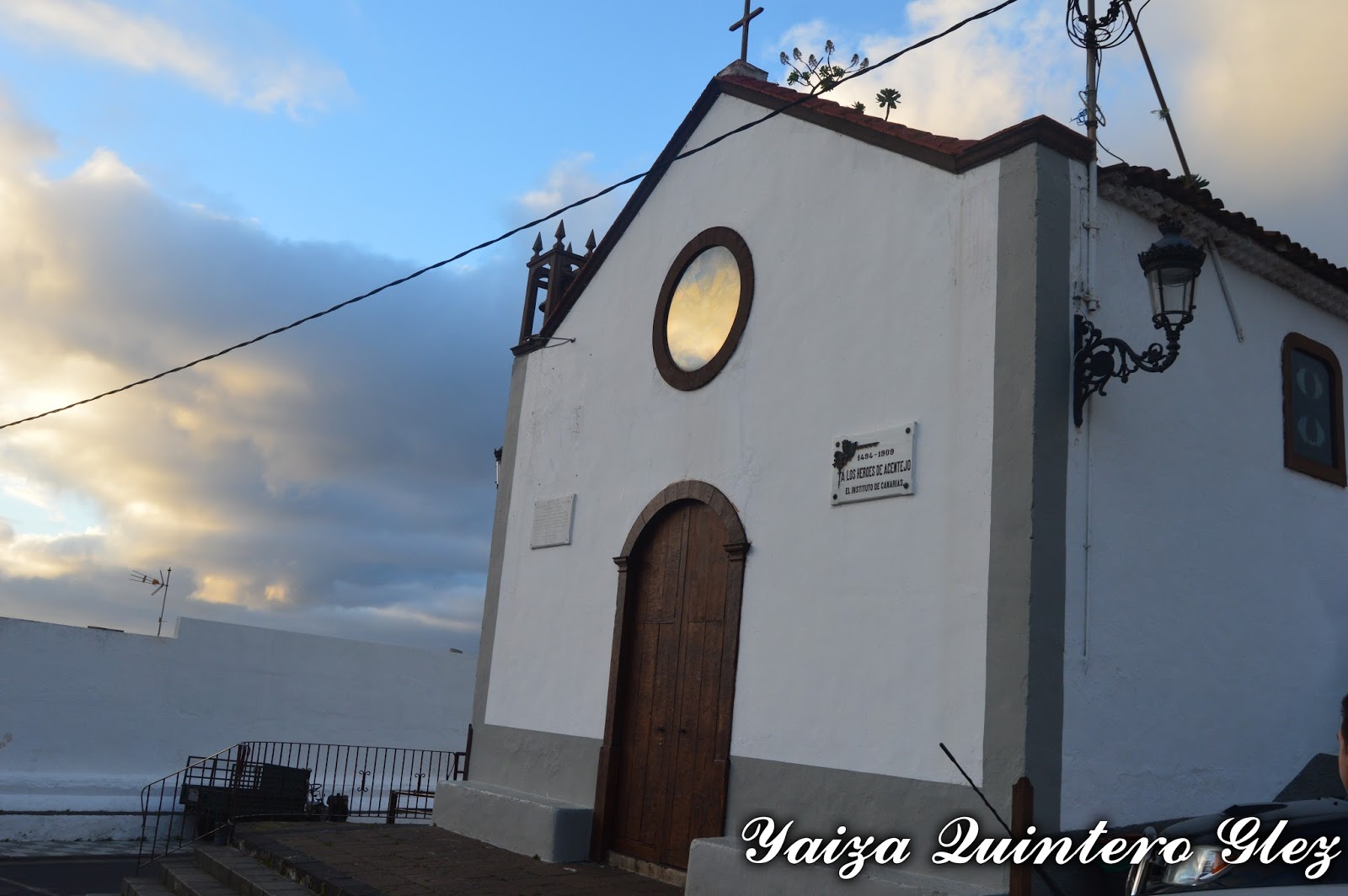
San Diego Hermitage: it was in an estate. It was modified and the current temple is about 1947.
 |
| San Diego hermitage |
Nuestra Señora de Guía Hermitage: in 1679, close of an estate with balconada (a big balcony)
 |
| Nuestra señora de Guía Hermitage |
San Antonio Hermitage: raised by one of the protagonists of the battle, who promised to construct it in the same place if his boss was saving it from this ambush. From these dates there was built by a worn image of the peninsula, that all the tradition that was the first image brought to the island. The holiday of San Antonio is and continues being very popular, where they were peregrinating with the cattle, of which he is the protector saint.
 |
| San Antonio hermitage |
Acentejo's ravine: declared BIC. It is also known as the Ravine of San Antonio, that it constitutes the principal channel of drainage of the region. It is born in the north slope of the Dorsal Mountain chain on the island, finishing in the Top of the Sabina (in the coast), after more than 6 linear km from the tour.
It presents a great number of caves and natural hollows that line up along the front of both slopes, many of which would have known a use habitacional, cattle or funeral during the pre-Hispanic stage.
The majority of the caves placed over the Highway of the North have been re-used by cattle purposes or as rooms of equipment, and most of the archaeological landfill has got lost. Nevertheless, they constitute a paradigmatic model of the prehistoric habitat of the north of Tenerife.
 |
| Ravine between La Matanza and La Victoria |
 |
| La Matanza painting |
Other places to visit in the main street:
Lagar of the real Street N º 198: El Lagar ( it is used to crush wine) is inside a rectangular construction, of approximately 50 m2 of surface, which walls are made of basaltic blocks of hewn stone. In the angles of the construction stones have been in use in the corner of basaltic nature. Only the south wall shows a different, more modern structure, since it is raised by prefabricated blocks.
El Hospicio: placed at the edge of the real way, which the people were crossing. In 1732 it was constructed a Franciscan hospice to receive in the same one the Franciscans and religious that were travelling between La Laguna and La Orotava. Nowadays the houses of high place remain and low with the gallery, the garden and the hermitage.
 |
| In Calle Real |
 |
| Calle Real |
Others of the real estate to visiting are
Fuente del Pino,
Casona Doña Sixta,
Salvador Hermitage, La Casa del Barco etc, across the nucleuses
Acentejo, El Caletón,
Guía, La Matanza, Las Breñas, San Antonio y San Cristobal.
 |
| Casa del Barco |
 |
| El Salvador Hermitage |
 |
| Doña Sixta House |