miércoles, 2 de septiembre de 2020

Los Roques de Garcia Path


Municiality: La Orotava
Aproximate duration: 01.30
Maximun height: 2189m
Minimun height: 2023m
Distance: 3,51km


Area information


The formation of these Roques is due to alignments of dykes, pythons and stacks of various volcanic materials, forming a wall that separated the two Calderas of Las Cañadas. Today it is eroded. 


This area is the most photographed place of the park, being able to have a perspective of the Teide along with Los Roques; of the Teide with the Finger of God (Roque Chinchado, the image of the old bill of 1000 pesetas), and to see the Llano de Ucanca.

The vegetation is composed by brooms (Eline microphylla), Tajinaste (Echium), elbows (Adenocarpus viscosus) and walnut trees (Erysimum scoparium) mostly.

The fauna is composed by lizards and beetles.


In the area it is possible to find the Pahoe Hoe and AA lava, which intersect along the route.

Description of the path


We are in the TF-24 of the Cañadas del Teide. Right where the Roques de García lookout spot is, on the other side of the road where the Parador is located. 

At this point you always find a lot of people (since there are the viewpoints) but the trail is not so busy (or at least when we did it).

We can leave the car in the parking lot, or we can get there with lines 348 (from Port) and 342 (from Adeje).


We started the trail going into Los Roques, just for that there is an area for disabled people, of about 12 minutes of duration. From this trail you can also access to the trail that goes up Pico Viejo.

It is a circular path and in the first flat stretch, the ground is not abrasive, being able to walk comfortably and with enough space

This first part is finalized, when we arrive at the point where the fork in the trail of Pico Viejo is located; and at the end of Los Roques we have already made the route back.


We start to descent in this second part of the trail, having to reach the feet of the cathedral (rocky formation that is located in Llano Ucanca and looks like a cathedral). 

On this descent the path is not as limited as the beginning (or we thought) and we stepped on the Pahoe hoe lava. It is not a descent as a great slope, but it is always necessary to be wide awake. 


At the end of this stretch, we arrived at the cathedral and from here we started to ascend to the viewpoint again. 

This third and last part is a zigzag slope where you have to go on single file. We go up to the side of the cathedral, passing in this stretch of being at the feet of it, to overcome its height.


miércoles, 1 de julio de 2020

Los Roques de Garcia


Municipio: La Orotava
Duración: 01:30
Desnivel máximo: 2189m 
Desnivel mínimo: 2023m
Distancia: 3,51km


Información sobre la zona


La formación de los Roques de García se debe a los alineamientos de diques, pitones y apilamientos de diversos materiales volcánicos.

En su momento formaban un muro que separaba las dos calderas de Las Cañadas. Hoy, se encuentran erosionados.


Podemos decir que esta zona es la más fotografiada del parque, pudiendo tener una perspectiva del Teide junto con Los Roques; del Teide con el Dedo de Dios (Roque chinchado, imagen del antiguo billete de 1000 pesetas); y ver el Llano de Ucanca.

La vegetación de la zona está compuesta por retamas (eline microphylla), tajinaste (Echium), codesos (Adenocarpus viscosus) y alhelíes (Erysimum scoparium), en su mayoría. 


La fauna esta compuesta por lagartos y escarabajos.

La orografía,  además de Los Roques, tenemos lavas pahoe hoe y las AA, que se intercalan a lo largo del recorrido.


Descripción del recorrido


Sendero y Mapa de Elevación
Nos encontramos en la TF-24 de las Cañadas del Teide. Justo en el parking donde está el mirador de los Roques de García: al otro lado de la carretera se encuentra el Parador. 

Este sitio tiene mucha afluencia de gente (ya que están los miradores) pero el sendero no es tan concurrido (o por lo menos cuando nosotros lo hicimos).

Podemos dejar el coche en el aparcamiento, o bien llegar con las líneas 348 (desde Puerto y es el parador donde hace la parada) y las 342 (desde Adeje).


Iniciamos el sendero adentrándonos en Los Roques, justo esa misma ruta tiene una zona habilitada para personas con movilidad reducida, de unos 12 minutos de duración. Desde este sendero también se accede al sendero que sube a Pico Viejo.

Es un sendero circular y en el primer tramo es llano, el suelo no es abrasivo, pudiendo caminar confortablemente y con bastante espacio.


Llegamos a un mirador, que es el punto donde se encuentra la bifurcación para el sendero de Pico Viejo; y al final de Los Roques ya hacemos la ruta de vuelta.

Esta parte del sendero es en descenso, teniendo que llegar a los pies de la catedral (formación rocosa que se encuentra en Llano Ucanca y parece un catedral). 

Durante la bajada, el sendero en el suelo no está bien delimitado como la primera parte (o a nosotros nos los pareció), ya que pisamos encima de las lavas Pahoe hoe. El descenso no es una gran pendiente, pero siempre hay que estar con todos los sentidos puestos.


Al finalizar este tramo, llegamos a la catedral y desde aquí empezamos a ascender hasta el mirador de nuevo.

Es una pendiente en forma de zigzag en la que se tiene que ir en fila india. Vamos subiendo al lado de la catedral, pasando en este tramo de estar debajo a la misma, a superar su altura.


lunes, 1 de junio de 2020

Arenas Negras Path


Arenas Negras
Municiality: La Orotava
Aproximate duration: 02:30 – 03:00
Maximun height: 2050m
Minimun height: 2300m
Distance: 47-48Km


Area Information


We are located within the Cañadas del Teide National Park. Arenas Negras is a volcanic cone formed by volcanic spikes. During this eruption fragment were thrown into the air and the lava was accumulating around the crater. 

El Llano de Maja, one of the areas that we passed on this route, was chosen by the Guanches for the pasture times, having here a settlement for the long summer seasons. This time of grazing was carried out in the Teide until 1954, when it was declared a national park and this activity was contradictory for the conservation purposes. 


The vegetation are mostly brooms (Teline microphylla and rhodorhizoides rhodorhizoides) , tajinastes (Echium)...

As for the fauna, they are mostly beetles, but we also find canaries and horseshoes.


Description of the path


We started the tour in the visitor center of the National Park. We have a parking area (so you can go by car), also taking line 342 (from Adeje) or line 348 (from El Puerto) from Titsa.

Once at this point of departure, we take the path of Siete Cañadas as in a few meters from the beginning we see the bifurcation of the two trails.


The first stage begins by ascending, although it is not a steep slope, but goes slowly. All this first part we are traveling through brooms and grasses, passing by the north face of the Mountain Cerrillar. 

From this part we can see the Guamazo Mountain (and if it is also clear some areas of the north of the island) and a few meters below the mountain is the road that comes from La Esperanza.

This first part and ground is not very abrasive, if being it in the mountain (rather volcano) of Arenas Negras (composed of Picon).

Finishing this part of the descent, we arrive at the plain of Maja, where the vegetation is somewhat more scarce


At the end of this plain, we arrive at Arenas Negras, passing by a ravine, where thanks to erosion we can see the different colors (looking like a cake) From this top we start the descent. The precautions have to be extreme, since being zahorra (small stones) is not stable, but the path is in the form of a zigzag.


Once we finish the descent, we take again the road of Siete Cañadas to reach the visitor center.
It is a circular path, so the journey becomes easier reaching the same starting point. The variety of colors and shapes accompany the entire trail.


sábado, 2 de mayo de 2020

Arenas Negras


Arenas Negras
Municipio: La Orotava
Duración aproximada: 2:30-03.00
Altitud mínima: 2050m
Altitud máxima: 2300m
Distancia Km: 7-8 Km

Esta publicación es para cuando podamos disfrutar de todo lo que nos rodea, caminemos,  conozcamos nuestro entorno....

Información sobre la zona


Nos encontramos dentro del Parque Nacional de las Cañadas del Teide.

Arenas negras es un cono volcánico formado de picón, de ahí el nombre del sendero. Durante esta erupción se lanzaron fragmentos al aire de lava que al caer, se acumularon en torno a la boca de emisión.


El Llano de Maja, una de las zonas por las que pasamos en este recorrido, era lugar elegido por los Guanches para las épocas de pastoreo, teniendo aquí un asentamiento para las largas temporadas estivales. Esta época de pastoreo se realizó en el Teide hasta 1954, fecha en la que se declaró Parque Nacional y esta actividad era contradictoria con los fines de conservación.


La vegetación de la zona, al estar dentro del parque, encontramos en su mayoría retamas (Teline microphylla  y (Retama rhodorhizoides ), tajinastes (Echium). 

En cuanto a la fauna su mayoría son escarabajos, pero también encontramos canarios y herrerillos.


Descripción del recorrido


Sendero y Mapa de Elevación

Empezamos el recorrido en el centro de visitantes del Parque Nacional. Tenemos una zona de aparcamientos (para los vayan en coche), también pudiendo coger la línea 342 (desde Adeje) o la línea 348 (desde El Puerto) de Titsa.

Una vez en este punto de salida, cogemos el sendero de Siete Cañadas y ya en unos pocos metros desde el comienzo, vemos la bifurcación de los dos senderos.

Parte del sendero
La primera etapa comenzamos ascendiendo, aunque no es una pendiente pronunciada, sino que va poco a poco. Toda esta primera parte la vamos recorriendo entre retamas y hierbas pajoneras, pasando por la cara norte de la Montaña Cerrillar. Desde esta parte podemos ver la Montaña de Guamazo (y si está despejado también algunas zonas del norte de la isla) y unos pocos metros por debajo de la montaña está la carretera que viene de La Esperanza.

En esta primera parte el suelo no es muy abrasivo, si siéndolo en la montaña (más bien volcán) de Arenas Negras (compuesto de picón).

Terminando esta parte de descenso, llegamos al Llano de Maja, donde la vegetación es algo más escasa.


Al finalizar el mismo , llegamos a Arenas Negras, pasando al lado de un barranco, donde gracias a la erosión podemos ver los diferentes colores (pareciendo una tarta). Desde esta cima empezamos el descenso. Hay que extremar las precauciones ya que al ser zahorra no es estable, pero el sendero está en forma de zigzag (que ayuda al descenso).


Una vez terminamos de descender, cogemos de nuevo el camino de Siete Cañadas para llegar al centro de visitantes.

Sendero durante el descenso

Es un sendero circular, así que el recorrido se hace más fácil llegando al mismo punto de partida. La variedad de colores y formas nos acompaña todo el sendero.

Recordar siempre, que estamos en alta montaña, por lo que hay que extremar las precauciones: llevar protección solar, gafas de sol, gorra, agua, etc.


miércoles, 1 de abril de 2020

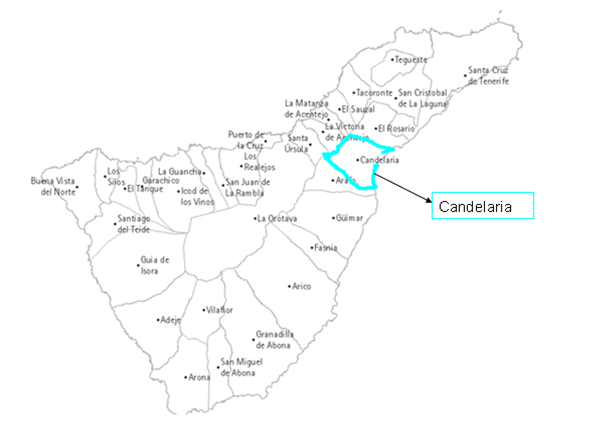
Candelaria

Municipality: Candelaria 


History

Candelaria, like almost all the municipalities of Tenerife, has coast and mountain. Its history is linked to the cult of Candelaria Virgin.

During the Guanche era, it was a passing town to Güímar, due to its winds and desert areas.

According to the legend, the Virgin of Candelaria appeared on the Güímar beaches around 1392, although it  could be around 1450. It is thought that it was transported by Franciscan friars to the convent of Betancuria in Fuerteventura between 1430-50. So, it is thought that the Virgin could have arrived for a decade or two before the conquest due to  the Marian cult among the southern aborigines and what explains that they joined the side of peace during the conquest.

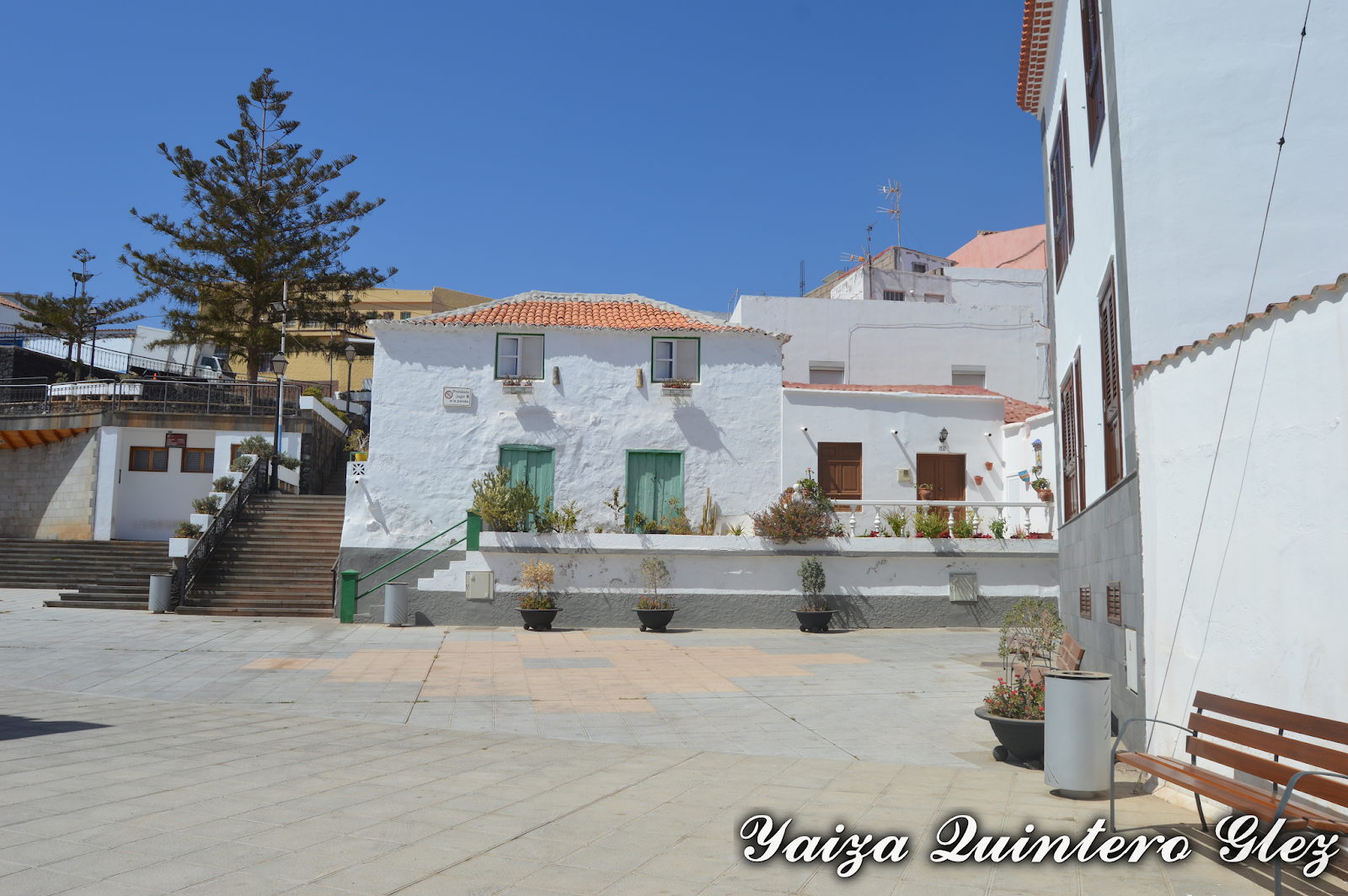
Candelaria
When the virgin was found, she was moved into some caves, and then to the cave of Achibinico, now  known as San Blas (the cave that is behind the Basilica). In 1497 a hermitage was built by order of El Adelantado. In 1535 the town council transferred to the Dominicans the Image, the house and hermitage. The town council took over the local festivities, the works of extension and the roads renovations . The convent was criticized for its dangerous location on the coast. 

The population of Candelaria was scattered among small places. The Cabildo builds a house in the area of temporary residence during the festivities (this house has a balcony and it is located just above the fountain). This example was followed by Los Condes de La Gomera and the  Marquis of Adeje, Los Baulen, etc.  Houses that were built between the convent and the cave-chapel.

Candelaria
The popular layers settled on the cliffs (caves first and then earthen houses around the church).

The soil of the municipality is very arid, so the men dedicated themselves to the fishing and the conduction of boats to supply fruits of the nearby villages. Because of this they excelled in migration as sailors.

Candelaria
The women dedicated themselves to the manufacture of earthenware, appreciated in much of the island and selling fish in the to the street. The fame of Candelaria’s pottery is such that each house has proper ovens to cook and shine.

Outside the town there are several villages of interest. In these areas there was subsistence agriculture (tripe, potatoes and wine) and caprine, wool and pig livestock.

Guanches
Candelaria’s urban growth has been spectacular since the 1970s; and since the 1980s, it has had frenzied urban speculation.

Houses

Representative buildings 


Santuario de la Virgen de Candelaria y Convento y bienes muebles vinculados: Declared Monument in 2005.

It has two towers of 35m high in the facade and one lateral of 45m. It has two access doors, the side opens to the square and the main to the Magdalena cliff. 

Its interior decoration is of the Doric order with a symbolic polychromy that alludes to the tones of the classical dress of the Virgin


Basílica de Candelaria

Las Pinturas de Manuel Martín González, located inside la Basílica de Candelaria: Declared Bien Mueble in 2013. The paintings are exposed at the foot of the temple nave. 

Painting nº 1 represents the lands of Chinguaro and nº 2 the beaches of Chimisay, as the aborigines were supposed to see when the Virgin appeared before the conquest of the Archipelago. 


Painting

Convento Dominico: Next to the Basilica and towards the sea, it has been restored since the 1960s in neocanary style and is articulated around a square cloister. The various convent units are the museum, the conference hall, the bookshop, hall, and the meeting hall. 

On the top floor are the rooms of the religious, the oratory, the library, kitchen and dining room. The most outstanding architectural element is the lateral stone door, with a lateral structure, which rests on half Corinthian columns.


Convento Dominico

Iglesia de San Blas: with a simple architectural façade, extending into the interior of the coastal cliff through the cave de San Blas.

Iglesia San Blas

El Camino de Candelaria: Declared a Historic Site in 2008.

Five sections of the traditional road are preserved, which is born at the end of the extension of the Camino de San Francisco de Paula (which goes to La Laguna) and ends at the Camino de la Cruz Colorada (near the C-822 road).

Candelaria way

Antiguo Ayuntamiento: It was built in the 17th century as a temporary residence of the island’s rulers, so it is also known as Casa Cabildo


Casa Cabildo

Centro alfarero: Known as the Casa de las Miquelas, it  is the center of the pottery, during the eighteenth and nineteenth centuries, the main industry of the municipality.

This center, located in a traditional house rehabilitated, owes its name to the last two potters of the neighborhood of Santa Ana.

It consists of three rooms, where it is possible to see the production process of traditional pottery, a collection of pottery and traditional clothing and a workshop


Centro alfarero

Iglesia Santa Ana: Founded by the inhabitants of the town that bears its name in 1575, it possesses a rich artistic heritage in its interior. The image of Santa Ana dates from the eighteenth century and the Crucified Christ, carved in wood and baroque style, from the seventeenth century.


Santa Ana church


Pozo de la virgen de Candelaria:. Declared Monument in 1993.

The place is well-known as a  religious significance related to the cult of the Virgin, although it was also used as a water catchment. The pilgrims who came to see the Virgin at the sanctuary, which is very close, quenched their thirst in this well.

The monument consists of a cave and an exterior enclosure, rectangular plan and battlement walls.


Candelaria