martes, 1 de octubre de 2019

Boca de Chavao

Municiality: Vilaflor
Aproximate duration: 0.20 min (go) 0.30 min (return)
Maximun height: 2078m
Minimun height: 1973m
Distance: 713 m


Area Information

This was the main access road to Las Cañadas of the inhabitants of the region of Isora, having several ramales (ways) coming from the different locations. 

We are walking at all times between pines, as we are in La Corona Forestal of the south of the island.

Path

Description of the path


The drop of the path

We are on track number 35 of the National Park of the Teide. To reach this path we must first walk along the path number 18 Chavao, either from Las narices del Teide viewpoint (just below the road) or from the Juan Évora Ethnographic Museum. In this case it was departing from the museum to reach this path.

We are on the road Tf-21 of Vilaflor. The area has parking, but which has a schedule to keep in mind.

Path

To reach the area, we can take different means of transports like Guagua (Bus), which from Puerto de la Cruz is line 348. From Costa Adeje, line 342. We take the road TF-21 (for La Orotava or for Vilaflor); TF-24 (for La Laguna); and TF-38 (Boca Tauce-Chío).

The path is signposted, but there is a different time of going and returning for the same one, due to the inclination..There are about 100 meters of unevenness, so to ascent always is more difficult.

Views
The path is signposted on the ground (it is well defined the path). On one side is the ravine (it is  not difficult to fall), and the other side is the wall of El Cedro. 


This path continues to Tagara, but if you only want to walk this one that in short time, the end is when we find the trail sign.


 Views
Path
Path


domingo, 1 de septiembre de 2019

Boca de Chavao

Municipio: Vilaflor
Duración aproximada del trayecto: 0:20 min (ida) 0:30 (vuelta)
Desnivel máximo: 2078m
Desnivel mínimo: 1973m
Distancia [Km]: 713m


Este mes toca hablar del sendero Boca de Chavao, ya que para acceder al mismo, hay que ir primero por el de Chavao, que fue la anterior publicación. 

Información sobre la zona


Esta era la principal vía de acceso a la cumbre, de los habitantes de la Comarca de Isora, teniendo varios ramales procedentes de los diferentes caseríos.

Vamos en todo momento entre pinos, ya que estamos en la Corona Forestal del sur de la isla.


Señal y sendero

Descripción del sendero


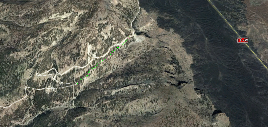
Recorrido y mapa de elevación

Nos encontramos en el sendero número 35 del Parque nacional del Teide. Para llegar a este sendero primero debemos de caminar por el sendero número 18 Chavao, bien desde el mirador de narices del Teide (da justo por debajo de la carretera) o bien desde el museo Etnográfico Juan Évora. En este caso se partió desde el museo para llegar a este sendero.

Estamos en la carretera Tf-21 de Vilaflor. La zona dispone aparcamiento, pero el cuál tiene un horario que hay que tener en cuenta.

Sendero
Para llegar a la zona podemos tomar diferentes medios como la Guagua, que desde el Puerto de la Cruz es la línea 348. Desde Costa Adeje, línea 342. Tomamos  la carretera TF-21 (por La Orotava o por Vilaflor); TF-24  (por La Laguna); y  TF-38 ( Boca Tauce-Chío).

El sendero esta señalizado, pero hay diferente hora de ida y vuelta por el mismo, debido a la inclinación, son unos 100 metros de desnivel, por lo que la subida siempre cuesta más.

Vistas
El sendero esta señalizado en el propio suelo, ya que esta marcado el camino, de todas formas por el lado del barranco es difícil que nos salgamos del mismo ya que caeríamos, y el otro lado es la pared del Cedro.

Este sendero continua hacía Tágara, pero si solo se desea recorrer este que en tiempo es corto, vemos el final cuando encontramos el cartel de sendero.


Sendero y Pico Viejo y Teide

jueves, 1 de agosto de 2019

Chavao

Municiality: La Orotava
Aproximate duration: 1:40
Maximun height: 2077m
Minimun height: 2040m
Distance: 2,10Km

Area information

During the walk, in addition to appreciating the typical flora of Las Cañadas (broom, walnut, elbow, broom, etc.), curious geological shapes like the lava beds (lavas almohadillas) and small fields of chordate lava (lavas cordadas) can be seen.

Landscape

Description of the path


The drop of the path


We are on track number 18 of the National Park of the Teide. This path is not circular, so we return to the same starting point along the same path. The good thing about this is that things that were left behing, can be appreciated.  

We started walking at the Juan Évora Ethnographic Museum, the last goat to live in the Teide. In this area there is parking, but it has an hour of closure, so if we do this  trail or Boca de Chavao (35); or we leave from here to Tagara (go and back), take into account this time.

Path
This place is on the TF-21 road that goes to the municipality of Vilaflor.

To reach to here, we can take different means of transports like Guagua, which from Puerto de la Cruz is line 348. From Costa Adeje, line 342. We can also go by car, having a parking area.

We take the road TF-21 (for La Orotava or for Vilaflor); TF-24 (for La Laguna); and TF-38 (Boca Tauce-Chío)

Path

It is a path that does not have much inclination, and it runs both between pine forest and between flows. Take into acount that it is easyto  have a silly fall.

On the right we have Pico Viejo, El Teide; and on the left hand side the walls and the area of the forest crown from the south of the island. From the viewpoint we head towards the Roque del Cedro leaving to the left La Cañada del Cedro.

Landscape
It is relatively flat, without great inclinations and is signposted at all times.

Pine
Landscape


lunes, 1 de julio de 2019

Chavao

Municipio: La Orotava
Duración aproximada del trayecto: 1:40
Desnivel máximo: 2077m 
Desnivel mínimo: 2040m
Distancia [Km]: 2,10km


Información sobre la zona

Durante el recorrido, además de apreciar la flora típica de las Cañadas (retama, alhelí, codeso, escobón, etc) Se aprecian curiosas formas geológicas como las lavas almohadilladas y pequeños campos de lavas cordadas.


Señal y sendero

Descripción del sendero


Recorrido y mapa de elevación

Nos encontramos en el sendero número 18 del Parque Nacional del Teide. Este sendero no es circular, por lo que volvemos al mismo punto de partida. Lo bueno de esto, es que aprecias cosas que antes quedaban de espaldas.

Iniciamos el sendero en el Museo Etnográfico Juan Évora, el último cabrero que habitó en las cañadas del Teide. En esta zona hay aparcamiento, pero tiene una hora de cierre, por lo que si hacemos este sendero o el de Boca de Chavao (35) o partimos desde aquí a Tágara ida y vuelta, tener en cuenta este hora.


Sendero
Este punto se encuentra en la carretera TF-21 que va hacia el municipio de Vilaflor.

Para llegar a las cañadas, podemos tomar diferentes medios como la Guagua, que desde el Puerto de la Cruz es la línea 348. Desde Costa Adeje, línea 342. 


Sendero

Tomamos  la carretera TF-21 (por La Orotava o por Vilaflor); TF-24  (por La Laguna); y  TF-38 ( Boca Tauce-Chío).

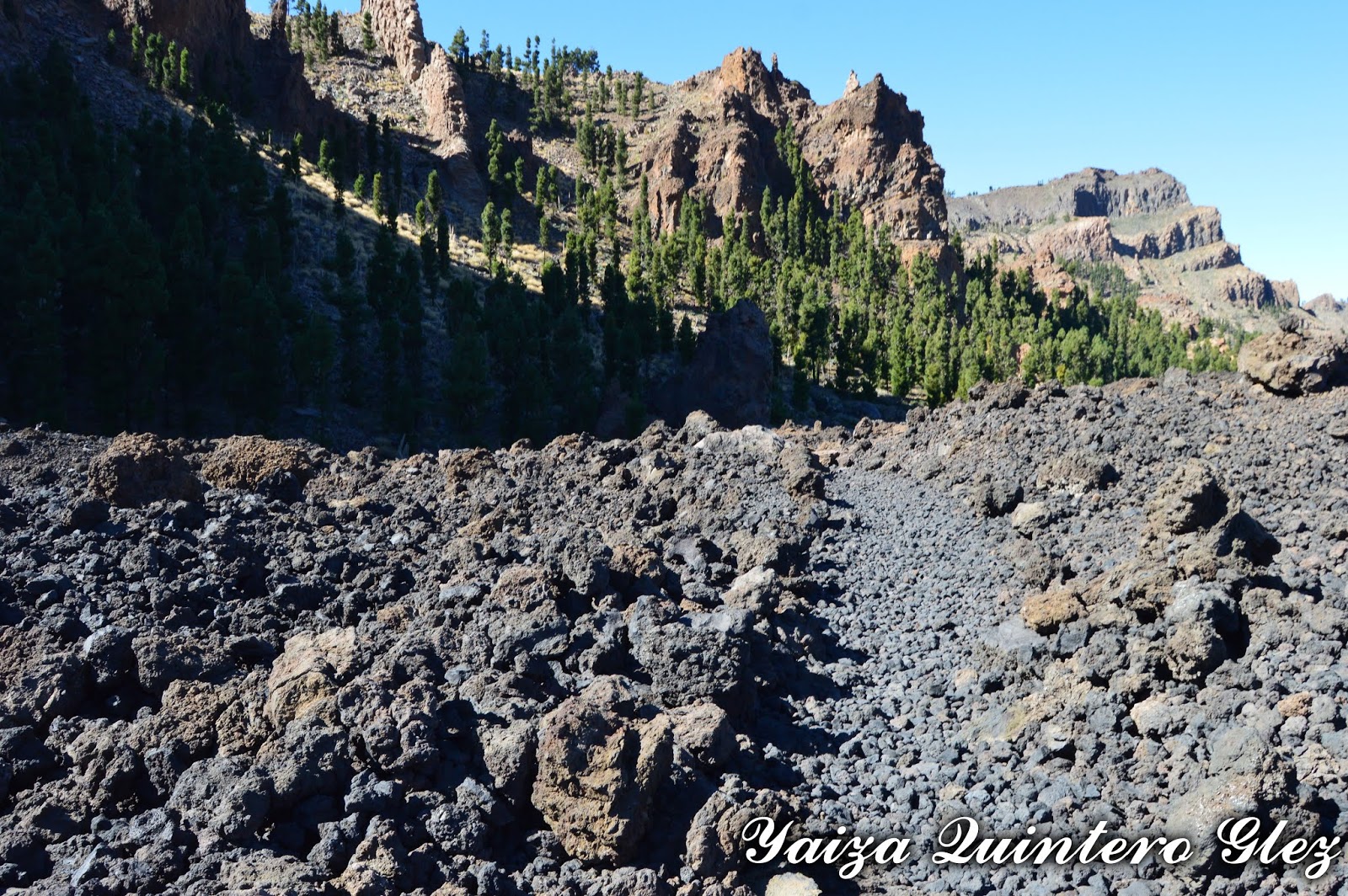
Es un sendero que no tiene mucha inclinación, y discurre tanto entre zona de pinar como entre coladas. El cuidado que hay que tener es sobre todo en las coladas, por las rocas sueltas que al pisar podemos tener una caída tonta.

Lava
A mano derecha tenemos Pico Viejo, el Teide, y a mano izquierda las paredes y la zona de la corona forestal desde el sur de la isla.  Desde el mirador nos dirigimos hacia el Roque del Cedro dejando a la izquierda la Cañada del Cedro

Pico Viejo y  Teide

Es relativamente llano, sin grandes inclinaciones y se encuentra señalizado en todo momento.

Vistas

lunes, 3 de junio de 2019

Teide-Pico Viejo-Majúa Path

Municipality: La Orotava
Aproximate duration: 08.00 Hours 
Maximun height: 3718m
Minimun height:2135m
Distance: 15Km


Area Information


This path that we are realizing is getting down El Teide, walking through PicoViejo. El Teide was declared as Natural Heritage of the Humanity in 2007.

Pico Viejo is a crater of approximately 800 meters of diameter and it is in approximately 3.100 meters of altitude. (To remember that it is prohibited to get inside the Crater). Pico Viejo shares the same volcanic building that El Teide.

The vegetation that we find is the characteristic of the area, as Brooms (Spartocytisus supranubius), Hierba Pajorera (Descurainia bourgaeana) and Rosalillos de Cumbre (Pterocephalus lasiospermus).


Pico Teide and landscape

Description of the path


The drop of the path

We are going to realize more than one path in Las Cañadas del Teide, extactly 2.

To come to the National Park, we can take the public transport: taxi or Bus (lines 348 and 342) and the car (parking in the qualified parkings).

We start by rising in the Teleférico del Teide (cable car). Once we come up, take the path to access to the peak (to remember that to rise it is necessary to have a permit, the rise during the day is restricted and the continuance of visitors in the area is 2 hours).

Path
On having come above, one enjoys of impressive views of Tenerife (north, south, eats and west) and of other islands. It is possible to see Gran Canria, La Gomera and La Palma. It is more difficult to see the other ones, El Hierro, Lanzarote and Fuerteventura. 

We begin to go down, and on having come to the shed of the teleférico, take to the right side (the left side, we go to the viewing-point of La Fortaleza, number 11). We take  the number 12 Viewing-point of Pico Viejo.

Pico Viejo
After coming to the viewing-point of Pico Viejo, we continue the path number 9 Teide- Pico Viejo. The path has indications all the time (signs and also we see the path drawn in the own  soil). We carry to extremes the precautions since a fall in the zone is the easiest thing.

We are walking for zones of washes, treading on volcanic bombs and also zones where the soil is more unstable, there being many gravel. On having come already to the crater of  Pico Viejo, we will have walked for 1 hour and 30 minutes (this duration is relative according to the people, in our case we were slow, observed the landscape, making photos and making  stopping)

Path
We come to Pico Viejo, and at the bifurcation with the path 23 Regatones Negros. After seeing the crater, we return again to walk to the bifurcation, and take the path number 23. This path has a duration going down for 3 hours, whereas rising it is 4 hours.

Landscape
When we start to descend, to our back  is Pico Viejo, and there are some places from where it is imposible to see El Teide. Always having in front of us, Las Cañadas with the highest point Guajara. 

Landscape

We cross zones of washes, and the last point coming to Los Roques de García, we tread on the lava  called Pahoe hoe.

We come to the crossing with Los Roques, and continue the  path towards the parking, directly to El dedo de Dios (image of the bill of 1000ptas). We go for the pokings, up to Las Cañadas, and here to the right hand, we find the path 19 of Majúa. At the end of this last one, we find the car. To know more on the path Majúa, read:
http://andandoportenerife.blogspot.com.es/search/label/Patrimonio%20Natural

This path was realized as a circulate one, returning to the starting point. Other option, is to leave one car in the parking of Los Roques ( we left it close to El Teleferico).

This path was realized in October, there is neither shade nor covered zone, from what many protections is advised and liquidate in case of realizing it in Summer.

Landscape

To reserve cable car:
https://www.volcanoteide.com/en/teide_cable_car

To access to Pico Teide:
https://www.reservasparquesnacionales.es/real/parquesnac/usu/html/detalle-actividad-oapn.aspx?ii=6ENG&cen=2&act=1