martes, 1 de mayo de 2018

Corral del Niño-Mal Abrigo-Montaña Limón

Municipio: La Orotava
Duración aproximada camino: 1:45 (ida)
Desnivel máximo: 2.288m
Desnivel mínimo: 2.099m
Distancia [Km]: 6,5km

Información sobre la zona


La vegetación en esta zona se caracteriza por tener bastantes retamas (Spartocytisus supranubius). En este caso es mejor ver la fotos y disfrutar.


Fotos de la floración durante el recorrido

Descripción del sendero


Recorrido y Mapa de elevación


El sendero del Corral del Niño, número 21 del Parque Nacional del Teide, lo iniciamos en la carretera TF-24, unos pocos metros antes de llegar al observatorio de Izaña (si vamos desde  el sentido La Orotava). 

Es un sendero que se inicia en el Corral del Niño (hay un mirador por lo que se puede dejar el coche) y acaba en  Montaña Limón (otro sendero que vemos la señal en el camino y dura aproximadamente unos 30 minutos ida), pasando por Yegua Blanca. 


Inicio del sendero

Pista del sendero

El mismo no tiene perdida, ya que discurre a través de una pista forestal. Es recomendable hacerlo en primavera, mes de mayo, ya que es precioso ver el contraste de colores con las retamas florecidas y en día despejado se puede ver la zona norte de la isla (Valle de la Orotava) e incluso la isla de La Palma. En cambio durante esa época en la zona hay asentamientos avícolas (por lo que puede ver alguna zona por la que se prohíbe pasar), así que cuidado con las abejas.

En este caso iniciamos el sendero y lo terminamos en la misma zona,  volvimos por el mismo recorrido que de ida.

Sendero

Vistas

En la zona encontramos varios grupos volcánicos hacia el norte de la isla.

Cabe recordar que estamos en alta montaña, la sombra es escasa por lo que siempre protección solar y agua.

Por esta vez, prefiero más disfrutar de las fotos, en vez de añadir mucha información. Despertar en cada uno esa curiosidad de querer ver por si mismo la zona. 

Vistas

Lavas

Vistas

lunes, 9 de abril de 2018

Bibliografía


http://turismo.garachico.es/index.php?option=com_content&view=section&layout=blog&id=6&Itemid=7&lang=es

http://garachico.wordpress.com/

http://www.bic-codepa.com/index.php?option=com_content&view=article&id=229:iglesia-de-nuestra-senora-de-la-antigua&catid=90:garachico&Itemid=110

http://turismo.puertodelacruz.es/

http://www.webtenerife.com/destinos-y-lugares/centros-historicos/centro+historico+de+puerto+de+la+cruz.htm

http://www.bic-codepa.com/index.php?option=com_content&view=category&id=98:puerto-cruz&layout=blog&Itemid=118&layout=default

http://www.citpuerto.com/es/puerto-de-la-cruz/historia/

http://www.villadelaorotava.org/conoce.php?op2=2

http://es.wikipedia.org/wiki/La_Orotava

http://www.webtenerife.com/sobre-tenerife/la-isla/municipios/la+orotava.htm

http://www.villadelaorotava.com/patrimonio.php

http://www.bic-codepa.com/index.php?option=com_content&view=article&id=240:iglesia-de-nuestra-senora-de-la-antigua&catid=97:orotava&Itemid=117

http://laciudaddeldrago.wordpress.com/historia/

http://franciscoadanfarina.blogspot.com.es/

http://www.elsauzal.es/

http://www.tacoronte.es/

https://lossilos.es/

http://www.garachico.es/

http://losrealejos.es/

http://eltanque.es/

http://www.lavictoriadeacentejo.es/

http://www.matanceros.es/

http://www.santaursula.es/ayto/

http://www.buenavistadelnorte.com/

http://www.laguancha.es/

http://www.gevic.net/

http://www.gobiernodecanarias.org/cultura/patrimoniocultural/bics/index.html

https://www.volcanodiscovery.com/es/canary-islands.html


lunes, 2 de abril de 2018

Tacoronte

Municipality: Tacoronte


History


After the conquest of the island, exactly in 1947 (the conquest ended on December 25, 1496) it is the date when the first bylines of distribution of this zone appeared, lands that were granted to Sebastián Machado, beneficiary of El Adelantado.

From this moment, the municipality is born in the environment of the current parish of Santa Catalina Mártir and is raised up to the convent Agustino del Cristo.

House

This zone was under the dependence of the municipality of El Sauzal, until in the year 1569 it has a mayor of a small town and the limits of the same one were fixed. But it is not up to the arrival of the Liberalism that  it turns into municipal corporation.

The shield of the city has a clear reference to the house of the founder, with five axes on field of gules, besides the heraldic crown, gallon of gold adorned with grapevine.

Tacoronte
The main role of the municipality was the agricultural, in middle zones and next the coast there is cultivated the malavasía and the vidueño (both cultures had the same luck that the rest of the island with the Portuguese emancipation, its principal market in case of the vidueño).

The economic growth reaches was during the XVIIth. In 1618 the pósito is constituted ( a posito is a depot), which indicates the strength of the cerealistic sector  wheat, barley, oats, rye and maize) and in 1685 there are constituted two granaries (store of cereals for the neighbors), only one of them continues is still constucted. 

Tacoronte

With the growth of the municipality, other small places were formed as San Jerónimo, San Juan, La Placeta and La Caridad between others. 

Other one of the products of the zone were the chick-peas, potatoes, wools, cheese, honey, wax and fishing, but always having special weight in the economy the malvasía and the vidueño, which before the fall of the same one, the  population was obliged to emigrate to find a better life. The only culture of wine that turns into excellency was red wine, whose varieties were planted at the end of the XVIIIth.


House
Many of these inhabitants came back to Tacoronte, but also they send remittances, which became visible in the mansions of the zone and the donations of objects of worship to the church

Also here La Cochinilla ( for natural tinge) was cultivated, but it was not the sufficiently strong to relieve sorrow. 

Town Hall
It was a stop  for the people who was going from La Laguna to the northern Tenerife. Exactly in 1901 it was the last stop of the streetcar, for what there appears a new urban environment of commercial nature, known as the Station.

In 1911 the King Alfonso XIII grants the title of City, it was immediately after a trip that he realized to the islands in 1906 and doing a stop in the missing person Hotel Camacho (hotel of  the beginning of the 20th century constructed with the growth of the new urban environment). 

Tacoronte

Representative Buildings


Casco de Tacoronte: BIC in 1980. In the 18th century there would be formed in Tacoronte a powerful elite of rich emigrants, whose demographic growth would be notable.

In the urban area there stand out some typical housings of the architecture of this nobility. They were maisonettes, with windows of guillotine and balconies of wood. Many of this real estate are of rectangular floor with walls of masonry and several show extraordinary works in hewn stone.

House with Balcony

El Calvario: Located in the street  of El Calvary and the beginning of the street of La Herradería, one agrees on an islet of triangular plant. It is surrounded of pines (some people said that they are the vestiges of the limit of the former forest).

The niche is glazed and in the interior it is possible to find a set of images: San Juan, la Magdalena y la Dolorosa. The Christ is a modern donated image.

El Calvario

La Alhónidiga: of rectangular form, two floors and walls of masonry. To the top floor it is necessary to acces  for a exterior stairs. It was constructed in 1685, with the purpose of guarding the bushels of wheat for remedy of the common needs of the village of  Tacoronte.

Nowadys the Public granary is destined to cultural purposes and, specially in benefit of everything what concerns the agriculture.

La Alhondiga
La Casona: The Casona is one of the most ancient houses that are in Tacoronte. It was given the orders to construct in the 18th century, with the aim to found in the chaplaincy of the parish

Probably The Casona should the name to the great size of its structure, one of the most ancestral characteristics of the building. In its white front, stands out the balconada  (balcony) that includes three large windows of the high floor and the roof. 


La Casona

Iglesia de Santa Catalina: BIC from 1986. This church is one of the best samples of the historical - artistic religious heritage. 

They are three ships of stones separated by columns pseudotoscanas, with cruise, sacristy and a tower. 

The covers of tiles to four waters are individualized for every ship, standing out the one that covers the major chapel and the cruise, to major height. In the interior, the armors of wood of torch.

The choir is of the 18th century, between the chapels, must be mentioned that of La Concepción, supported by the family Machado and roof with geometric decoration without policromar; that of El Rosario,  with the altarpiece of major artistic quality of the temple; Las Animas of the last third of the XVIIIth.

Santa Catalina Church

Iglesia del Santísimo Cristo de los Dolores y Exconvento: BIC 2006.

The  north and principal front is worked in thin hewn stone.  The convent, with the ships and attached cloister to the temple, also presents the main face.  

This front is characterized also by the distribution and game of the masses been employed at the stone, brought together with the lightness of the whitewashed cloths, hollows of wood of torch and covers of tile as indicators of the Canary traditional architecture.

Santísimo Cristo Church
Between the hermitages that we find in the zone, to emphasize that of San Jerónimo (constructed in 1654,), San Juan Bautista (1631) and  La Caridad (17th century and Parish from 1945).

San Juan Hermitage

Other place of interest in the municipality it are La Fuentecilla - Juan Fernandez (archaeological place) and Acantilados de Tacoronte y Barranco de Guayonge (archaeological place).

Coast
There have not been mentioned all the places that are located along this municipality, but the most important thing is to create the first impression on the zone to later visit them. As other already published municipalities and those who stay, they are only one small summary to wake the reader up this feeling of wanting to investigate more and to visit it.


viernes, 16 de marzo de 2018

Tacoronte

Municipio: Tacoronte 


Historia


Tras la conquista de la isla, exactamente en 1947 (la conquista terminó el 25 diciembre de 1496) es cuando aparecen las primeras datas de repartición de esta zona, tierras que  fueron concedidas a Sebastián Machado, beneficiado del adelantado. 

A partir de este momento el municipio nace en el entorno de la actual parroquia de Santa Catalina Mártir y se erige hasta el convento Agustino del Cristo.

Casas Tacoronte
Esta zona estuvo bajo la dependencia del municipio de El Sauzal, hasta que en el año 1569 dispone de un alcalde pedáneo y se fijan los límites del mismo. Pero no es hasta la llegada del Liberalismo que se convierte en corporación municipal. (El escudo de la ciudad hace clara referencia a la casa del fundador, con cinco hachas sobre campo de gules en clara referencia a su importancia vinatera y de tierras fértiles). 

Municipio agrícola por excelencia, el grano es su cultivo fundamental, aunque en zonas de medianías y próximas a la costa se cultiva el malavasía y el vidueño blanco (ambos cultivos corren la misma suerte que el resto de la isla con la emancipación portuguesa, su principal mercado en el caso del vidueño).

Ayuntamiento
El crecimiento económico alcanza su auge en el año XVII. En 1618 se constituye el pósito, lo que indica la pujanza del sector cerealístico (trigo, cebada, avena, centeno y maíz ) y en 1685 se constituyen dos graneros, alhóndiga, (almacén de cereales para los vecinos),solo uno de ellos sigue en pie hoy en día.

Con el crecimiento del municipio, se formaron otros pequeños núcleos como San Jerónimo, San Juan, La Placeta y La Caridad entre otros.

Tacoronte
Otro de los productos de la zona también son garbanzos, papas (este cultivo comienza su auge cuando decae la vocación cerealística por la competencia de granos foráneos), lanas, queso, miel, cera y pesca, pero siempre teniendo especial peso en la economía el malvasía y el vidueño, que ante la caída de la misma, su población se ve obligada a emigrar para encontrar una vida mejor. El único cultivo de vino que se convierte en sinónimo por excelencia es el vino tinto, cuyas variedades se plantan de forma significativa a fines del XVIII.

Muchos de estos habitantes vuelven a Tacoronte o sus descendientes, pero también envían remesas, que se hicieron visibles en las mansiones de la zona y las donaciones de objetos de culto a la iglesia.

Tacoronte
También aquí se cultivó la cochinilla, pero no es lo suficientemente fuerte para paliar las penas.

Por esta zona iban de la La Laguna al Norte y en 1901 era la última parada del tranvía, por lo que aparece un nuevo entorno urbano de naturaleza comercial, conocida como la Estación.

En 1911 el Rey Alfonso XIII otorga, a raíz de un viaje que realizó a las islas en 1906 y haciendo una parada en el desaparecido Hotel Camacho (hotel de principios del siglo XX construido con el crecimiento del nuevo entorno urbano), el título de Ciudad.

Costa de Tacoronte

Inmuebles a visitar


Casco de Tacoronte: Bic 1980.  En el siglo XVIII se formaría en Tacoronte una poderosa élite de ricos emigrantes, cuyo crecimiento demográfico sería notable.

En el casco urbano sobresalen algunas viviendas típicas de la arquitectura de esta nobleza. Eran casas de altos y bajo con ventanas de guillotina y balcones de madera. Muchos de estos inmuebles son de planta rectangular con muros de mampostería y varias muestran trabajos extraordinarios en cantería.

Casas de Tacoronte

El Calvario: Ubicado en la calle El Calvario y el inicio de la calle La Herrería, se asienta sobre una isleta de planta triangular. Se encuentra circundada de pinos (algunos afirman que son los vestigios del límite del antiguo bosque que bajaba desde los altos del municipio).

El nicho se encuentra acristalado y en su interior se puede apreciar un conjunto de imágenes: San Juan, la Magdalena y la Dolorosa. . El Cristo es una imagen moderna  donada.

El Calvario
La Alhóndiga: de forma rectangular, dos plantas y muros de mampostería. A la planta superior se accede por una escalera en el exterior. Construido en 1685, con la finalidad de custodiar las fanegas de trigo para remedio de las necesidades comunes del pueblo de Tacoronte.

En la actualidad, la Alhóndiga se destina a fines culturales y, especialmente, en beneficio de todo lo que concierne a la agricultura.

Alhondiga
La Casona: La Casona es una de las casas más antiguas que se conservan en Tacoronte. Fue mandada a construir en el siglo XVIII, con el objetivo de fundar en ella la capellanía de la parroquia.

Quizás La Casona deba su nombre al gran tamaño de su estructura, una de las características más solariegas del inmueble. En su fachada blanca, destaca la balconada que abarca los tres ventanales de la planta alta y el tejado.

Una vez dejó de ser capellanía, la planta baja de la casa fue el juzgado del pueblo. Después pasó a manos privadas y cambió varias veces de propietario hasta que finalmente fue comprada por el Cabildo, actual titular del inmueble.

La Casona
Iglesia Santa Catalina: BIC desde 1986.  Esta iglesia es una de las mejores muestras del patrimonio histórico-artistico religioso insultar.

Son tres naves de piedras separadas por columnas pseudotoscanas, con crucero capilla mayor, sacristía y una torre con su cuerpo de campanas de doble vano en cada frente.

Las cubiertas de tejas a cuatro aguas se individualizan para cada nave, sobresaliendo la que cubre la capilla mayor y el crucero, a mayor altura. En el interior, las armaduras de madera de tea, con pares de tirantes y decoración de motivos geométricos de estrellas. 

El coro es del siglo XVIII, entre las capillas, debe ser citada la de la Concepción, patrocinada por la familia Machado y techumbre con decoración geométrica sin policromar; la del Rosario , con el retablo de mayor calidad artística del templo, con artesonado dorado y policromado; la de las Ánimas, del último tercio del XVIII.

Iglesia Santa Catalina
Iglesia Santísimo Cristo de los Dolores y Exconvento: BIC 2006.

Su fachada norte y principal está trabajada en cantería fina, esta particularidad le brinda monumentalidad. 

El convento, con sus naves y claustro anexo al templo, también presenta su fachada principal por su cara norte, en el mismo plano y a continuación de la fachada de la iglesia. Se caracteriza también esta fachada por la distribución y juego de las masas trabajadas en la piedra, conjugada con la ligereza de los paños encalados, huecos de madera de tea y cubiertas de teja como indicadores de la arquitectura canaria tradicional.


Iglesia Santísimo Cristo
Entre las ermitas que se encuentran en la zona, destacar la de San Jerónimo (construida en 1654, ), San Juan Bautista (1631)  y La Caridad (siglo XVII y Parroquia desde 1945).

Ermita San Jerónimo
Otros lugar de interés en el municipio son La Fuentecilla - Juan Fernández  (lugar arqueológico) y Acantilados de Tacoronte y Barranco de Guayonge (lugar arqueológico).

Costa Tacoronte
No se han mencionado todos los lugares que se encuentran a lo largo de este municipio, pero lo más importante es crear una primera impresión sobre la zona para así luego visitarla. Este, como los otros municipios ya publicados y los que quedan, son sólo un pequeño resumen  para despertar al lector ese sentimiento de querer indagar más y visitarlo.

domingo, 18 de febrero de 2018

Path from Los Silos to Buenavista

Municiality: Los Silos-Buenavista 
Aproximate duration: 1:15 H (go and back)
Maximun height: 17m
Minimun height: 4m
Distance: 3 ,15km (go) 


Area Information

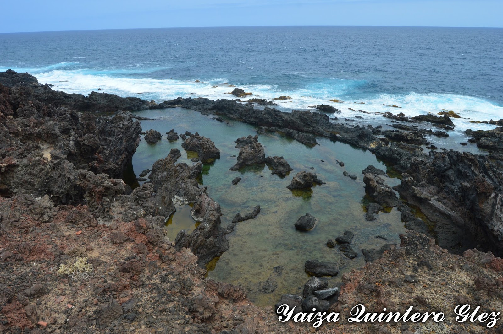
It is a path , where we go across the coast. In this zone we find natural puddles and rocky zone, where it is possible to see the different forms of the lava on having entered in touch with the water.


The predominant vegetation are the tuneras (Opuntia ficus-indicates), tabaibas (Euphorbia balsamifera) and cardones (Pachycereus pringlei). Also we find several greenhouses of banana plantations.


The Path

Description of the Path 


The drop of the path

We are in the municipality of Los Silos, exactly in the nearest of the municipal swimming pool.

In this point that possesses parking, we can leave the car. Or to come to the zone by bus (line 107 Santa Cruz-Buenavista); (line 363 Puerto de la Cruz-Buenavista): or by taxi.

We beggin  the path taking the track that one finds to the left side of the whale, a skeleton of whale, similar to the one which ran aground on the coast.


Lava and the path

It is common to find during the walk cars and bicycles,  so it is comfortable and wide enough to walk. It does not have great  slope and at all time we are near to the coast. It is a path trought a road, withouth signposting, but it is the own  track the one that is showing us  the direction of the same one.


Along the tour we are finding some puddles where it is possible to swimm (charco Don Gabino, Charco de los Chocos, la zona de los Esposos, etc)

Coast

We go in direction  towards Buenavista's municipality of the North, just the poing where one finds the beacon. Before coming to the same one we find El Rayo (the Beam), a hollow formed by the sea erosion (though it is said that it was produced by a beam).

El Rayo

In this case we finish in Buenavista's beacon, but there is a possibility of continuing for the coast of the above mentioned municipality and of managing to connect with the golf course, or, since in this case on having come to the Beam we returned to the beginning zone. 

On having been  in the coast, having remembered that in heat days we do not have zone of shade and it is possible to make a bit costly, but we can refresh with the bath, always with precaution.


During the path