domingo, 18 de febrero de 2018

Path from Los Silos to Buenavista

Municiality: Los Silos-Buenavista 
Aproximate duration: 1:15 H (go and back)
Maximun height: 17m
Minimun height: 4m
Distance: 3 ,15km (go) 


Area Information

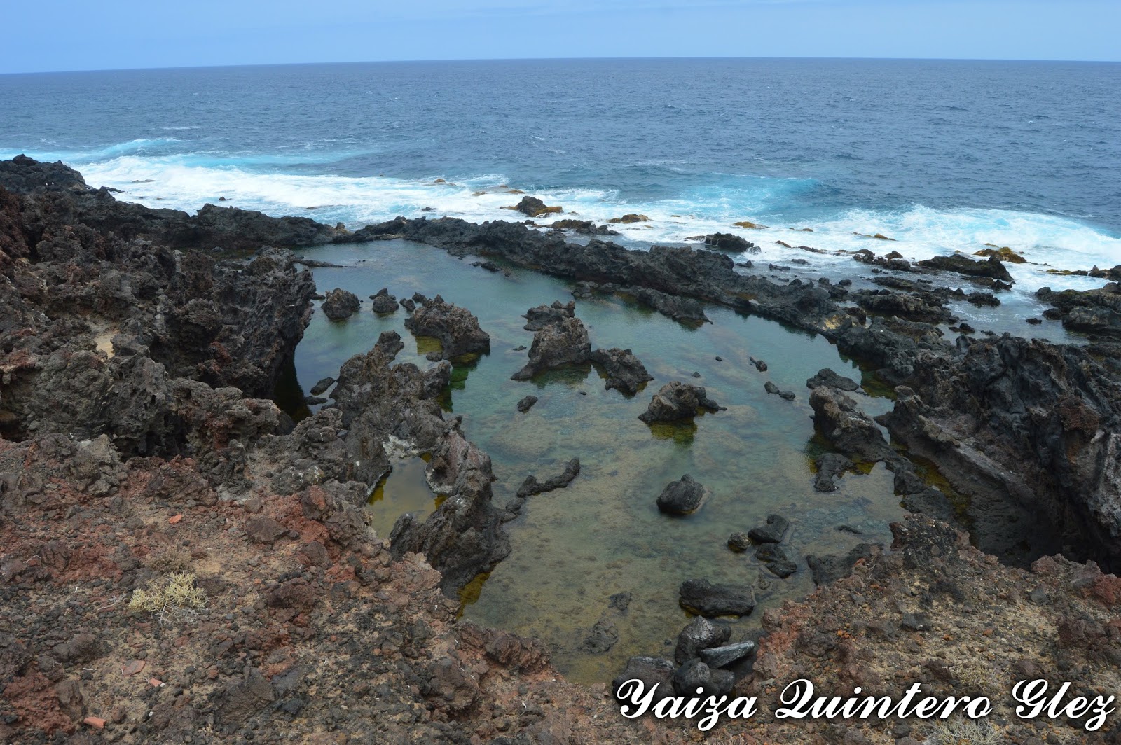
It is a path , where we go across the coast. In this zone we find natural puddles and rocky zone, where it is possible to see the different forms of the lava on having entered in touch with the water.


The predominant vegetation are the tuneras (Opuntia ficus-indicates), tabaibas (Euphorbia balsamifera) and cardones (Pachycereus pringlei). Also we find several greenhouses of banana plantations.


The Path

Description of the Path 


The drop of the path

We are in the municipality of Los Silos, exactly in the nearest of the municipal swimming pool.

In this point that possesses parking, we can leave the car. Or to come to the zone by bus (line 107 Santa Cruz-Buenavista); (line 363 Puerto de la Cruz-Buenavista): or by taxi.

We beggin  the path taking the track that one finds to the left side of the whale, a skeleton of whale, similar to the one which ran aground on the coast.


Lava and the path

It is common to find during the walk cars and bicycles,  so it is comfortable and wide enough to walk. It does not have great  slope and at all time we are near to the coast. It is a path trought a road, withouth signposting, but it is the own  track the one that is showing us  the direction of the same one.


Along the tour we are finding some puddles where it is possible to swimm (charco Don Gabino, Charco de los Chocos, la zona de los Esposos, etc)

Coast

We go in direction  towards Buenavista's municipality of the North, just the poing where one finds the beacon. Before coming to the same one we find El Rayo (the Beam), a hollow formed by the sea erosion (though it is said that it was produced by a beam).

El Rayo

In this case we finish in Buenavista's beacon, but there is a possibility of continuing for the coast of the above mentioned municipality and of managing to connect with the golf course, or, since in this case on having come to the Beam we returned to the beginning zone. 

On having been  in the coast, having remembered that in heat days we do not have zone of shade and it is possible to make a bit costly, but we can refresh with the bath, always with precaution.


During the path 


martes, 16 de enero de 2018

Los Silos-Buenavista


Municipio: Los Silos-Buenavista
Duración aproximada camino: 1:15h (ida y vuelta)
Desnivel máximo: 17m
Desnivel mínimo: 4m
Distancia [Km]: 3,15 km (ida)

Información sobre la zona


Es un sendero que discurre a través de la costa. En esta zona encontramos charcos naturales y zona rocosas, donde es posible ver las diferentes formas de la lava al entrar en contacto con el agua.

La vegetación predominante son las tuneras (Opuntia ficus-indica) , tabaibas dulces (Euphorbia balsamifera) y cardones (Pachycereus pringlei). También encontramos varios invernaderos de plataneras.


Vistas desde el sendero y en el sendero

Descripción del Sendero 


Recorrido y Mapa de elevación

Nos encontramos en el municipio de Los Silos, justamente en la costa donde se encuentra la piscina municipal.

En este punto que posee aparcamiento, podemos dejar el coche. O bien llegar a la zona en guagua (línea 107 Santa Cruz-Buenavista); (línea 363 Puerto de La Cruz-Buenavista): o bien un taxi. 

Iniciamos el sendero tomando la pista que se encuentra al lado izquierdo de la ballena, un esqueleto de ballena, similar al que encalló en su costa. 

Sendero

Es una pista de tierra por la que pasan coches y bicicletas, así que es cómoda y bastante amplia para caminar. No tiene mucha pendiente y en todo momento vamos pegados a la costa. Es un sendero que no esta homologado, así que carece de señalización, pero es la propia pista la que va enseñando la dirección del mismo.

A lo largo del recorrido vamos encontrando algunos charcos donde es posible darse un buen baño (charco Don Gabino, Charco de los Chocos, la zona de los Esposos, etc)

Charco
Vamos en dirección hacia el municipio de Buenavista del Norte, justo por donde se encuentra el faro. Antes de llegar al mismo encontramos el Rayo, un hueco formado por la erosión del mar (aunque se dice que fue producido por un  rayo). 

En este caso terminamos en el faro de Buenavista, pero esta la posibilidad de continuar por la costa de dicho municipio y llegar a conectar con el campo de golf, o bien, como en este caso al llegar al Rayo volvimos a la zona de salida.

Sendero
Al estar pegado a la costa, recordar que en días de calor no tenemos zona de sombra y se puede hacer un poco costoso, pero podemos refrescarnos con el baño, siempre con precaución. 

Zona del Rayo

sábado, 25 de noviembre de 2017

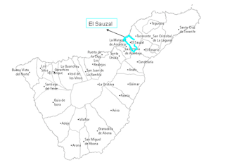
El Sauzal

Municipality: El Sauzal

History


During Los Guanches epoch, the population centered was established in the zone of the coast, since it was a rich place in spring. In this zone it was found  numerous caves of room, where there were ceramics; and sepulchral, with mummies and funeral apparel.

Having finished the conquest, the zone was one of the priority villages in being colonized. Alonso Fernandez of Lugo had some of the zone. Between the inhabitants there were Portuguese, Catalans, Andalusians, Italians, Flemings and slaves and they were concentrating the area in absentees (this land had the highest taxes on the island).


A viewpoint

The first population nucleus tried to be raised in the environment of the hermitage of  Nuestra Señora de los Ángeles (Our lady of the Angels) in 1505, but due to the rough topography of the municipality, being constructed in the promontory (considerable Height of land. The considerable height of land that advances in the sea.). So in this place it was constructed San's Pedro Church in 1515, and the principal one of the Angels stayed as a hermitage, though it was the image of dedication and protector of the village.

This municipality suffered a growth, so in the XVI century it turned into the governing center of Acentejo's region.


In El Sauzal
This municipality did not have sugar ingenuity, but the first cultures where the cereal and the vineyard (malvasía wine and vidueño white, the red wine got in the 18th century). The kindness of the temperature and a pleasant climate where the definition of the zone. In 1572 El Cabildo (Administrative exclusive entity of the Canary Isles) of La Laguna was moved to El Sauzal, due to the pest of tumors or bubonic that existed in La Laguna.

The export of different variety of grapevine (sweet, white, dry and vidueño) does that the zone suffers an economic growth. Also the municipality  was benefited from being a step obliged to the real way of La Orotava, and the pier served for communications with the island of La Palma.

View
But after years of growth the crises appears, where the humblest population sees as only  bulging the migration. This wine crisis extinguished the culture of the malvasía, taking as a solution the vidueño. Emigration that unlike other municipalities did not have the return of Indian is enriching to the municipality, for what it entered into "battle" with Tacoronte in the beneficiary of the region.


In 1812, the Sauzal turns into municipal corporation.

In Las Rojas
The vineyard of the zone enters in decadence owed partly to a plague. With the introduction of the wood-louse the crisis manages to be paralyzed during some time. The culture  of the banana in the 20th century seems to relieve a little the emigration, but that will continue to exist until the middle of the 60. In this epoch the population uses towards Santa Cruz and La Laguna (in previous epochs also the population was used in this municipality, especially women who were employed as laundresses at the well-off houses).

The zone of culture was reduced during the centuries, the soil has suffered speculation, and possesses big urbanizations on having turned into the priority zone as the second residence for foreigners and people accommodate of Santa Cruz and La Laguna, due to the kindness before spoken (climate and coast).

Square
The population are working in the services sector and construction. The zone of culture that has been occupied by construction, and the one that stays is divided between plots for the vineyard (the zone is famous for the broths); followed by potatoes; and the banana plantation is scarcely non-existent.


Reprensentative Buildings

Parroquia de San Pedro (San's Pedro parish): it was declared BIC. The church possesses a Latin cross floor plant  with the major chapel of domed cover. The tower of the 18th century offers quadrangular plant. 

From the content of the church it is necessary to distinguish the  picture of Ánimas (Souls), anonymous of the 18th century of classic structure in three planes, with good color and in very acceptable condition of conservation


San Pedro Church

San Nicólas Hermitage: principle of the 17th century, emphasizing the altarpiece of popular school.

San Nicola Church
Nuestra Señora de Los Ángeles: from1505. The votive offerings were abundant, since the population was entrusting themself to the image in epochs of misfortune. Stands out the baroque altarpiece and the sculpture of bundle


Los Angele Hermitage


Also there can be mentioned the hermitages Cruz de Lucio and El Calvario.

Museum of the Wine: former estate, of half of the XVIIth. It was composed by two bushels of malmsey wine, two hermitages and two lagares (where the grape is trodden or presses to obtain the mosto( wine juice)). It has a notable artesonado (that is decorated with carved ceiling panels, especially the ceilings)

Wine Museum
Los Lavaderos: current municipal park, place of relaxation for villagers and visitors. Still the water of the springs flows. They can be seen several plant species. Some years ago it was a place to wash the clothes.

Los Lavaderos
Museum of La Siervita: Maria de Jesus was born in 1643 in this municipality, exposes her incorrupt corpse on February 15 in La Laguna, in commemoration of her death in 1731. The house possesses a schedule, being on Mondays and closed Tuesday.

La Siervita Museum
Museum of the Canary fight: it was inaugurated in 2010. This one is located in the House of Los Callejones it is a building of municipal ownership with two floors. It is a question of a house rehabilitated in 2005. Rectangular floor and covered to four waters, extending the back skirt up to the level of ground floor, prototype of the traditional architecture of the zone. To be visited it is necessary to bear the schedule of opening in mind.

Canary fight Museum
La Casa Roja: the front gives the General Road of the North. It is a question of an ancient and historical building. The restoration was carried out between November, 2008 and November, 2010 and it was rehabilitated  in almost ruinous condition, realizing different works , masonry, plumbing and carpentry

Red House
La Casa de la Palmera: it is a question of a traditional Canary housing, renewed in November, 2006. The north front is of a floor of height, whereas the south front, it possesses  two floors, being an element to emphasizing that the division between  both plants  is done by means of a structure of wood. The work contemplated the rehabilitation of the pavements, the covers and the coatings as well as works of carpentry, painting and new electrical facilities.

La Palmera House

viernes, 27 de octubre de 2017

El Sauzal

Municipio: El Sauzal


Historia


Durante la época guanche, la población se concentró en la zona de la costa, ya que era un lugar rico en manantiales. En esta zona se encontraron numerosas cuevas de habitación, donde había cerámicas; y sepulcrales, con momias y ajuar funerario.

Al terminar la conquista fue uno de los pueblos prioritarios en ser colonizados (por sus manantiales), teniendo tierra para si Alonso Fernández de Lugo. Entre los habitantes había portugueses, catalanes, andaluces, italianos, flamencos y esclavos, donde fueron concentrando el terreno en mayorazgos absentitas (esta tierra tenía los tributos más altos de la isla).

El primer núcleo trató de erigirse en el entorno de la  ermita de Nuestra señora de los Ángeles sobre 1505, pero debido a la accidentada topografía del municipio, construyéndose en el promontorio (Altura considerable de tierra. Altura considerable de tierra que avanza en el mar.) En este lugar se construyo la Iglesia de  San Pedro 1515, y la principal de los Ángeles quedó como ermita, aunque fuera la imagen de advocación  y protectora del pueblo.


Ayuntamiento
Este municipio sufrió un crecimiento, en el sigloXVI se convirtió en el centro rector de la comarca de Acentejo. También poseyó la parroquia titular teniendo su cura una renta.

No tuvo ingenio azucarero, sino que sus primeros cultivos fueron el cereal (trigo) y el viñedo (malvasía y vidueño blanco, el tinto se introduce en el siglo XVIII). La benignidad de la temperatura y un apacible clima son lo que definen a esta zona. En 1572 se traslada el Cabildo de la Laguna al Sauzal, debido a la peste de landres o bubónica que había en La Laguna.

La exportación de las diferentes variedad de vid (dulce, blanco, seco y vidueño) hace que la zona sufra un crecimiento económico y en la misma se asientan numerosos jornaleros. También el municipio se vio beneficiado por ser paso obligado al camino real de La Orotava, y su embarcadero sirvió para comunicaciones con la isla de La Palma.


Vistas
Pero tras años de crecimiento comienzan las crisis, donde la población más humilde ve como única salida la migración. Esta crisis vinícola extinguió el cultivo del malvasía, teniendo como única salida vidueño blanco de mesa. Emigración que a diferencia de otros municipios no tuvo el retorno de indianas enriqueciendo el municipio, por lo que entró en batalla con Tacoronte por el beneficiado de la comarca.

El municipio poseía un Postigo; no tuvo convento; la escuela se creó a partir del XVIII, pero a la que apenas iban niños debido a la pobreza de su población, en donde se necesitaba su mano de obra.

En 1812, el Sauzal se convierte en corporación municipal. 

El viñedo de la zona entra en decadencia debido en parte a una plaga. Con la introducción de la cochinilla la crisis logra paralizarse durante algún tiempo. El cultivo del plátano en el siglo XX parece paliar algo la emigración, pero que seguirá existiendo hasta mediados de los 60. En esta época su población se emplea hacia Santa Cruz y La Laguna (en épocas anteriores también su población se emplea en este municipio sobre todo mujeres que trabajaban como lavanderas en las casas acomodadas), especialmente en el sector portuario.

Casas
La zona de cultivo se ha visto mermada durante los siglos, el suelo ha sufrido especulación, y posee grandes urbanizaciones al convertirse en zona prioritaria como segunda residencia para extranjeros y gente acomodad de Santa Cruz y La laguna, debido a la benignidad antes hablada (clima y costa).

La población se emplea entre el sector servicios y construcción. La zona de cultivo que ha sido ocupada por construcción, y la que queda se divide entre parcelas para el viñedo (la zona es famosa por sus caldos); seguido de las papas; y la platanera es apenas inexistente.

Calle El Sauzal

Inmuebles más representativos


Parroquia de San Pedro: declarada BIC. La iglesia posee planta de cruz latina con su capilla mayor de cubierta abovedada . Adosada a ella, la sacristía de planta rectangular se manifiesta al exterior como un pequeño cuerpo con cubierta de tejas a cuatro aguas.

La fachada principal mira hacia el oeste y cuenta con una torre de cuatro alturas adosada hacia el costado sur. La portada es dintelada, con cornisa y un remate en forma de frontón de extremos curvilíneos en cantería. La torre del siglo XVIII ofrece planta cuadrangular.

Del contenido de la iglesia cabe destacar su cuadro de Ánimas, anónimo del siglo XVIII de estructura clásica en tres planos, con buen colorido y en muy aceptable estado de conservación.

Iglesia San Pedro

Ermita San Nicolás: principio del siglo XVII, destacando el retablo de escuela popular.


Ermita Nuestra Señora de los Ángeles: 1505. Eran abundantes los exvotos, ya que la población se encomendaba a la imagen en épocas de desgracia. Destaca el retablo barroco y la escultura de bulto

Ermita Los Angeles

También se pueden mencionar las ermitas de Cruz de Lucio y El Calvario.

Museo del Vino: antigua hacienda, de mitad del XVII. Estaba compuesta por dos fanegas de malvasía, casas ermitas y dos lagares. Alberga un notable artesonado.

Museo del Vino
Los antiguos lavaderos: actual parque municipal, lugar de relax para lugareños y visitantes. Todavía fluye el agua de los manantiales. Se pueden ver dragos, cedros, ñameras, sauces entre varias especies vegetales.

Los Lavaderos
Casa Museo La Sierva de Dios: María de Jesús nacida en 1643 en este municipio, se expone su cadáver incorrupto el 15 de febrero en La Laguna, en conmemoración de su muerte en 1731. La casa posee un horario, estando los lunes y martes cerrado.

Casa-Museo La Sierva
Museo de la lucha canaria: fue inaugurado en 2010. Esta ubicado en la Casa de Los Callejones, es un edificio de titularidad municipal con dos plantas de altura. Se trata de una casa rehabilitada en 2005. Planta rectangular y cubierta a cuatro aguas, prolongándose el faldón trasero hasta el nivel de planta baja, prototipo de la arquitectura tradicional de la zona. Para ser visitado hay que tener en cuenta el horario de apertura.


Museo de la Lucha Canaria
La Casa Roja: su fachada da la Carretera General del Norte. Se trata de un inmueble antiguo e histórico. Su restauración se llevó a cabo entre noviembre de 2008 y noviembre de 2010 y corrió a cargo de la Escuela Taller Casa Roja, han rehabilitado el inmueble en estado casi ruinoso, realizando diferentes trabajos de albañilería, fontanería y carpintería.

Casa Roja
La Casa de la Palmera: Se trata de una vivienda tradicional canaria, renovada en noviembre de 2006. Su fachada norte es de una sola planta de altura, mientras que la fachada sur, cuenta con dos alturas, siendo un elemento a destacar que la división entre las dos plantas se hace mediante una estructura de madera. Los trabajos contemplaron la rehabilitación de los pavimentos, las cubiertas y los revestimientos así como obras de carpintería, pintura y nuevas instalaciones eléctricas.

Casa La Palmera
Hemos nombrado algunos de los inmuebles tan representativos, sin embargo quedan muchos a los largo de toda la ortografía del Sauzal, que sólo se descubren cuando se visitan.