miércoles, 28 de junio de 2017

Los Valles


Municipio: La Orotava
Duración aproximada del trayecto: 1:30H (ida) 2:00H (vuelta)  
Desnivel máximo: 2296m (aprox)
Desnivel mínimo: 2052m (aprox)
Distancia [Km]: 5km (aprox)


Información sobre la zona


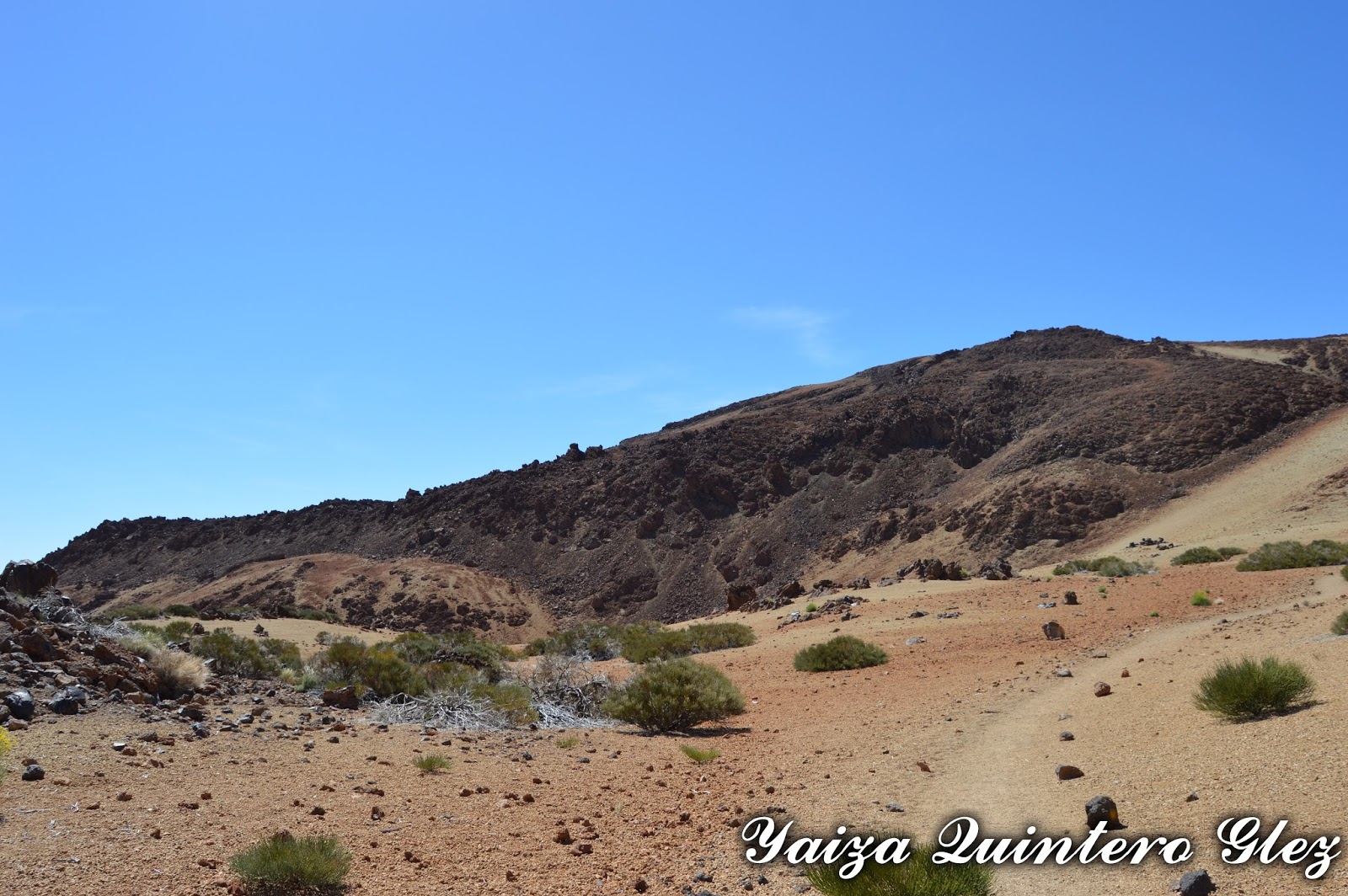
Nos encontramos dentro del Parque Nacional del Teide.

La particularidad de este sendero, es que esta zona tiene su importancia histórica, ya que fue una zona de extracción de piedra pómez y también fue zona de cargadero de leña de retama.

Sendero
A lo largo del recorrido, se observan varias de las especies vegetales más representativas del matorral de alta montaña canario, como puede ser retama del teide (Spartocytisus supranubius). 

Sendero

Descripción del sendero


Nos encontramos en el sendero número 30 de la red de senderos del parque nacional del Teide. Empezamos justo en el mirador de Las Minas de San José, y este desciende hasta siete cañadas.

Para llegar a la zona, tomamos  la carretera TF-21 (por La Orotava o por Vilaflor); TF-24  (por La Laguna); y  TF-38 ( Boca Tauce-Chío). Podemos tomar diferentes medios como la Guagua (desde el Puerto de la Cruz es la línea 348, y desde Costa Adeje, línea 342). También podemos ir en coche, teniendo zona de aparcamiento en el mirador por el que justo empieza el sendero. En esta misma zona encontramos varios carteles informativos del lugar.

Vistas
El sendero no es circular, por lo que al llegar a Siete Cañadas retrocedemos por el mismo sendero, para llegar a la zona del aparcamiento. 

Empezamos, como se ha dicho, en el mirador de las minas de San José y finalizamos delante de la Cañada de la Pila (una de las siete cañadas).  En este punto se puede coger por Siete Cañadas y terminar bien en el parador, o en el centro de visitantes. Pero en este caso se eligió volver al mismo punto de partida.

Los Valles
No tiene dificultad, el primer tramo es llano, para luego empezar a descender, no es un desnivel de golpe, sino que se desciende poco a poco, teniendo en cuenta que la vuelta se hace en mas tiempo ya que hay que subir y siempre cuesta mas.

El sendero esta señalizado, tanto por el número de sendero y la señalética, como por las piedras formando el sendero en el suelo.

Sendero

Recordar, que al encontrarnos dentro de las Cañadas no tenemos sombra así que protección solar y mucha agua. Es una zona de caza, estando cerrado algunos días en temporada de caza (hay carteles que  indican que días). En la época de  floración,  hay que tener cuidado con las abejas. 

Vistas
Sendero
Vistas


miércoles, 31 de mayo de 2017

From Montaña de los Tomillos to Recibo Quemado

Montaña de los Tomillos- Montaña Rajada- Montaña Blanca-Lomo Hurtado- Recibo Quemado


Municiality: La Orotava
Aproximate duration: 5-6 hours
Maximun height: 2530 m 
Minimun height: 2050 m 
Distance 16,4Km (aprox)

Area Information


We are in Las Cañadas del Teide. Already, in other paths that we have done, we have commented some information of this zone, but since we have realized several paths in one, commenting on some of the most important characteristics of every path.

Montaña de los Tomillos: This path has a historical value since it was the former way that there were using the first explorers and the recollections of sulphur and of ice. La Montaña de los Tomillos is a volcanic cone that stands out in the landscape for the dark tone. Also in the zone, we find enough deposits of pumice with vegetation composed for codesos (Adenocarpus viscosus) and brooms (Spartocytisus supranubius)

Path
Montaña Rajada: The whole area is covered of pumice, proceeding from the violent eruptions plainness' of Montaña Blanca.
Montaña Rajada
Montaña Blanca: It is an example of volcanismo issuing explosive of pumice. It  is on this place where we will be able to see the Ahelí del teide (Erysimum scoparium). 

In Montaña Blanca
Lomo Hurtado: In this path we find pumice too. The broom is the vegetable dominant species along the path, accompanied by some other species as the hierba pajonera (Descurainia bourgeauana).

From Lomo Hurtado
Recibo Quemado: This path is also one of the former ways of raise from the Valley of The Orotava to the pastures of the summit. In the low part we find a Canary pinegrove, which gives on progressively to the bushes of summit.

Recibo Quemado

Description of the path 


The drop of the path

The path is a circular path, so we return to the point of item. In order that this was possible, we have realized several paths of the same time. This way it is possible to return to the  beginning point, without passing for the same place.

To come hire we can use the Bus (line 348 and 342); the car; or the taxi. If we decide to go in the car, we can use the zone of parking it surrounds to the visitors' center, and if we take other means of transport, we stop in the zone of the visitors' Center (place of beginning and return of the path).

Sings
All these paths are put up signs, and they are:

Montaña de los Tomillos: path 6
Montaña Rajada: path 27
Montaña Blanca: path 7 (sin ir al pico del teide)
Lomo Hurtado: path 22
Recibo Quemado: path 25

We initiate the path in the visitors' center, and take sensible towards the strength. After walking during approximately 20 minutes, we find a bifurcation to the left hand that indicates the path to us towards Montaña de los Tomillos.

This section is continuously raised, but without too many problem. Once we finish this section, come to another bifurcation that indicates us if we continue until the end of this path or take to left hand for that of Montaña Rajada.

Path
What is characterize to this section is the slope that has and the dark colors of the mountain and the black of the obsidian. We are bordering on the domes of  Montaña Blanca and Montaña Rajada, where it is impressed the sights of both volcanic domes.

On having finished this section we come to Montaña Blanca (we come more in, not to the road from the one that  Montaña Blanca) begins . This one is the most used and the showy part of the National Park. Once here we find a slope that close to the altitude, does that it is a notably tiring tour. We finish in La Rambleta, close to the Viewing-point of  La Fortaleza.

Montaña Blanca
We return for the path that indicates Lomo Hurtado that connects the high part of the Valle de la Orotava with Montaña Blanca. Only in the top section it has a slightly pronounced difference (that is our case we have taken it  to go down) but of rest it is a flat enough path of walking. We finish the path in the crossing between the path of La Fortaleza and the path Recibo Quemado.

Burnt receipt is in constant slope, so what we lower initially, we are going to have to raise it. On having finished it we come near the general road, for what at all time we hear the cars that are passing. From this path we can observe scarp them of El Cabezón one and La Fortaleza, as well as The Teide and Montaña Blanca.

In Recibo Quemado
When we return, we come to the bifurcation with the path of La Fortaleza and Lomo Hurtado, and take to the right to go to the Visitors' Center, finishing like that our path 5 in 1.

It is the recommendations to do the path in epoch before or later to the summer, since on having been in high mountain the shade is scanty and they give more the sunstrokes. In April, May and June bear in mind that it is an epoch of proliferation of the bees and there are zones of beehives.

La Fortaleza


jueves, 20 de abril de 2017

Desde Montaña de los Tomillos hasta Recibo quemado

Montaña de los Tomillos- Montaña Rajada- Montaña Blanca-Lomo Hurtado- Recibo quemado


Municipio: La Orotava
Duración: 5-6 Horas (aprox)
Altitud máx: 2530 m (aprox)
Altitud min: 2050 m (aprox)
Distancia: 16,4Km (aprox)

Información sobre la zona

Nos encontramos dentro de las Cañadas del Teide. Ya en otros senderos que hemos hecho, hemos comentado algo de esta zona, pero como hemos realizado varios senderos de una vez, comentamos algunas de las características más importantes de cada sendero.

Sendero

Montaña de los tomillos: Este sendero tiene un  valor histórico ya que era  el antiguo camino que utilizaban los primeros exploradores y los recolectores de azufre y de hielo. Montaña de los tomillos es un cono volcánico que destaca en el paisaje por su tono oscuro. También en la zona encontramos bastantes depósitos de piedra pómez con vegetación compuesta por codesos (Adenocarpus viscosus) y retamas (Spartocytisus supranubius

Hacia Montaña de los Tomillos
Montaña Rajada: Todo el terreno está cubierto de piedra pómez, procedente de las violentas erupciones plinianas de Montaña Blanca

Montaña Rajada

Montaña Blanca: Es un ejemplo de volcanismo explosivo emisor de piedra pómez. Es en este sitio donde podremos ver el alheli del teide

En Montaña Blanca
Lomo Hurtado: También en este sendero encontramos piedra pómez. La retama es la especie vegetal dominante a lo largo del sendero, acompañada de alguna otra especie como la hierba pajonera (Descurainia bourgeauana) .

Vistas a Lomo Hutado y La Fortaleza

Recibo Quemado: Este sendero es también uno de los antiguos caminos de subida desde el Valle de La Orotava a los pastos de la cumbre. En la parte inferior encontramos un pinar canario, que da paso progresivamente al matorral de cumbre.

Recibo Quemado

Descripción del sendero


Recorrido y mapa de elevación

El sendero es un sendero circular, así que volvemos al punto de partida. Para que esto fuera posible hemos realizado varios senderos de una misma vez. Así se puede volver al punto de partida, sin pasar por el mismo sitio.

Para llegar hasta aquí podemos utilizar la Guagua  (línea 348 y 342); el coche; o el taxi. Si decidimos ir en coche, podemos utilizar la zona de aparcamiento cerca al centro de visitantes, y si cogemos los otros medios de transporte, nos paramos en la zona del Centro de visitantes (lugar de comienzo y regreso del sendero).

Comienzo del sendero
Todos estos senderos están señalizados, y son:

Montaña de los Tomillos: sendero 6
Montaña Rajada: sendero 27
Montaña Blanca: sendero 7 (sin ir al pico del teide)
Lomo Hurtado: sendero 22
Recibo Quemado: sendero 25

Iniciamos el sendero en el centro de visitantes, y cogemos sentido hacia la fortaleza. Tras caminar durante unos 20 minutos encontramos una bifurcación a mano izquierda que nos indica el sendero hacia Montaña de los Tomillos.

Este tramo es un continua subida, pero sin demasiado problema. Una vez terminamos este tramo, llegamos a otra bifurcación que nos indica si seguimos hasta el final de este sendero o cogemos a mano izquierda por el de Montaña rajada.

Sendero
Lo que caracteriza a este tramo es la pendiente que tiene (subimos por una montaña) y los colores oscuros de la montaña y el negro de la obsidiana. Vamos bordeando los domos (montículo que se forma cuando las pilas de lava se amontonan sobre el respiradero de un volcán) de Montaña Blanca y Montaña Rajada, donde impresionan las vistas de los dos domos volcánicos. 

Al terminar este tramo llegamos a Montaña Blanca (llegamos más adentro, no a la carretera de la que parte Montaña Blanca). Este es el sendero más utilizado y llamativo del Parque Nacional. Una vez aquí nos encontramos con una  pendiente que junto a la altitud, hace que sea un recorrido notablemente fatigoso. Terminamos  en La Rambleta, junto al Mirador de La Fortaleza.

Sendero
Regresamos por el sendero que indica Lomo Hurtado, sendero que conecta la parte alta del Valle de La Orotava con Montaña Blanca. Sólo en el tramo superior tiene un desnivel algo pronunciado (que es nuestro caso lo hemos cogido bajando) pero de resto es un sendero bastante llano de caminar. Finalizamos el sendero en el cruce entre el sendero La Fortaleza y el sendero Recibo Quemado.

Recibo Quemado es en pendiente continua, así que lo que bajamos al principio, lo vamos a tener que subir. Al terminarlo llegamos cerca de la carretera general, por lo que en todo momento vamos oyendo los coches que pasan. Desde este sendero podemos observar los escarpes del Cabezón y La Fortaleza, así como El Teide y Montaña Blanca.

En Lomo Hurtado
Cuando regresamos, llegamos a la bifurcación con el sendero de La Fortaleza y Lomo Hurtado, y cogemos a la derecha para dirigirnos al Centro de Visitantes, terminando así nuestro sendero 5 en 1.

Las recomendaciones es hacer el sendero en época anterior o posterior al verano, ya que al estar en alta montaña la sombra es escasa y dan más las insolaciones. En los meses de abril-mayo-junio tener en cuenta que es época de proliferación y hay zonas de colmenas.

El Cabezón

lunes, 20 de marzo de 2017

La Matanza de Acentejo

Municipality: La Matanza de Acentejo


History


Before the Castilian epoch, the municipality was integrated  under the Menceyato de Taoro and in the Menceyato de Tacoronte (depending wherefrom it is reading, we can find it inside one or another one, or of both Menceyatos).

Always it  has been characterized for being a municipality of the slopes and of irregular volcanic washes. The limit is divided between  the Ravine of La Cabrera with El Sauzal, and the San Antonio one with La Victoria.

View from La Matanza
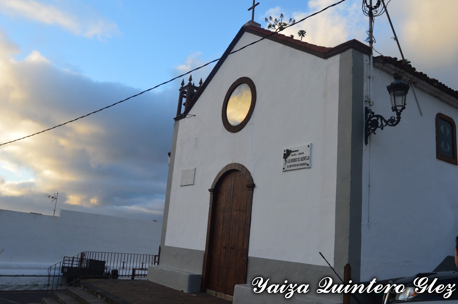
In this municipality Los Guanches obtained the victory on the conquerors (if there there comes the name of the municipality, taken on the battle that the Original inhabitants of the Canary Isles gained on the Castilians), event that it  forced Fernandez of Lugo to retire from the island and to look for reinforcements. It was in Acentejo's ravine (though it is doubted on the exact place) where the battle takes place, taking advantage Los Guanches of the local orography for the ambush.

Since it finishes the conquest, in the territory cereals and grapevine are cultivated. In the XVIIth and XVIIIth century the development of the vineyard (especially the white one, the red wine interferes at the end of the XVIIIth) in this zone, raises it to the regional hegemony, close to La Victoria. There exists a small elite of local owners (though most they were laborers and lessees), enriched with the benefits of the wine and the agriculture for the subsistence. But the majority of the fertile lands concerned  to oligarchies laguneras (people from La Laguna) and orotavenses (people from La Orotava). In the high and medium zones they predominate over the cereals, wheat, and then it appears eats it and the mill.

Some houses
This municipality does not remain exempt from the wine crises that were lived, by what they are summarized in migrations. It is the wheat the production that manages to survive. With the migrations of the males to obtain send, in the field relevancy charges more the women and children. During the whole history, the municipality being seen the inhabitants declining and to get bigger, according to the crises or the economic recoveries that are happening.

In this municipality a deposit existed towards the ends of the XVIth. The crafts had representation very small. The Slaughter was a place of step obliged to all those persons who were going to the valley and northwest, for what it possessed from the ends of the XVIth a put and inn. In the population, they were not possessing doctors, but quacks.

Some houses

The population was centered in  the center of the town, and then some dispersed houses for the rest of the municipality. They were possessing several fountains, but they were not in use for the irrigation for not having the funds to be able to finance the work.

The restaurants constitute the major source of employment in this locality. In the soil an essential culture of grapevine continues to exist..

Some houses

Representative Buildings 


It is possible to say the municipality possesses the best city center preserved of the region, with casonas (big houses) of agrarian bourgeoises. The principal temple survived a fire in 1936, for what in the current temple some images remain.

San Diego Hermitage: it was in an estate. It was modified and the current temple is about 1947.

San Diego hermitage

Nuestra Señora de Guía Hermitage: in 1679, close of an estate with balconada (a big balcony)

Nuestra señora de Guía Hermitage
San Antonio Hermitage: raised by one of the protagonists of the battle, who promised to construct it in the same place if his  boss was saving it from this ambush. From these dates there was built by a worn image of the peninsula, that all the tradition that was the first image brought to the island. The holiday of San Antonio is and continues being very popular, where they were peregrinating with the cattle, of which he is the protector saint.

San Antonio hermitage

Acentejo's ravine: declared BIC. It is also known as the Ravine of San Antonio, that it constitutes the principal channel of drainage of the region. It  is born in the north slope of the Dorsal Mountain chain on the island, finishing in the Top of the Sabina (in the coast), after more than 6 linear km from the tour.

It presents a great number of caves and natural hollows that line up along the front of both slopes, many of which would have known a use habitacional, cattle or funeral during the pre-Hispanic stage.

The majority of the caves placed over the Highway of the North have been re-used by cattle purposes or as rooms of equipment, and most of the archaeological landfill has got lost. Nevertheless, they constitute a paradigmatic model of the prehistoric habitat of the north of Tenerife.

Ravine between La Matanza and La Victoria
La Matanza painting

Other places to visit in the main street:

Lagar of the real Street N º 198: El Lagar ( it is used to crush wine)  is inside a rectangular construction, of approximately 50 m2 of surface, which walls are made of basaltic blocks of hewn stone. In the angles of the construction stones have been in use in the corner of basaltic nature. Only the south wall shows a different, more modern structure, since it is raised by prefabricated blocks.


El Hospicio: placed at the edge of the real way, which the people were crossing. In 1732 it was constructed a Franciscan hospice  to receive in the same one the Franciscans and religious that were travelling between La Laguna and La  Orotava. Nowadays the houses of high place remain and low with the gallery, the garden and the hermitage.

In Calle Real

Calle Real

Others of the real estate to visiting are Fuente del Pino, Casona Doña Sixta, Salvador Hermitage, La Casa del Barco etc, across the nucleuses Acentejo, El Caletón, Guía, La Matanza, Las Breñas, San Antonio y San Cristobal. 


Casa del Barco
El Salvador Hermitage
Doña Sixta House